Stormwater Management Program
The Takoma Park Stormwater Management Program is established to achieve the following goals:
- Maintain and replace stormwater infrastructure;
- Perform stream restoration projects and other water quality improvement projects;
- Add stormwater treatment facilities, such as green streets;
- Provide funding to study, design and construct stormwater management facilities.
The Program is funded through the stormwater management utility fee, which is based on each property’s actual contribution to stormwater runoff.
Stormwater Runoff
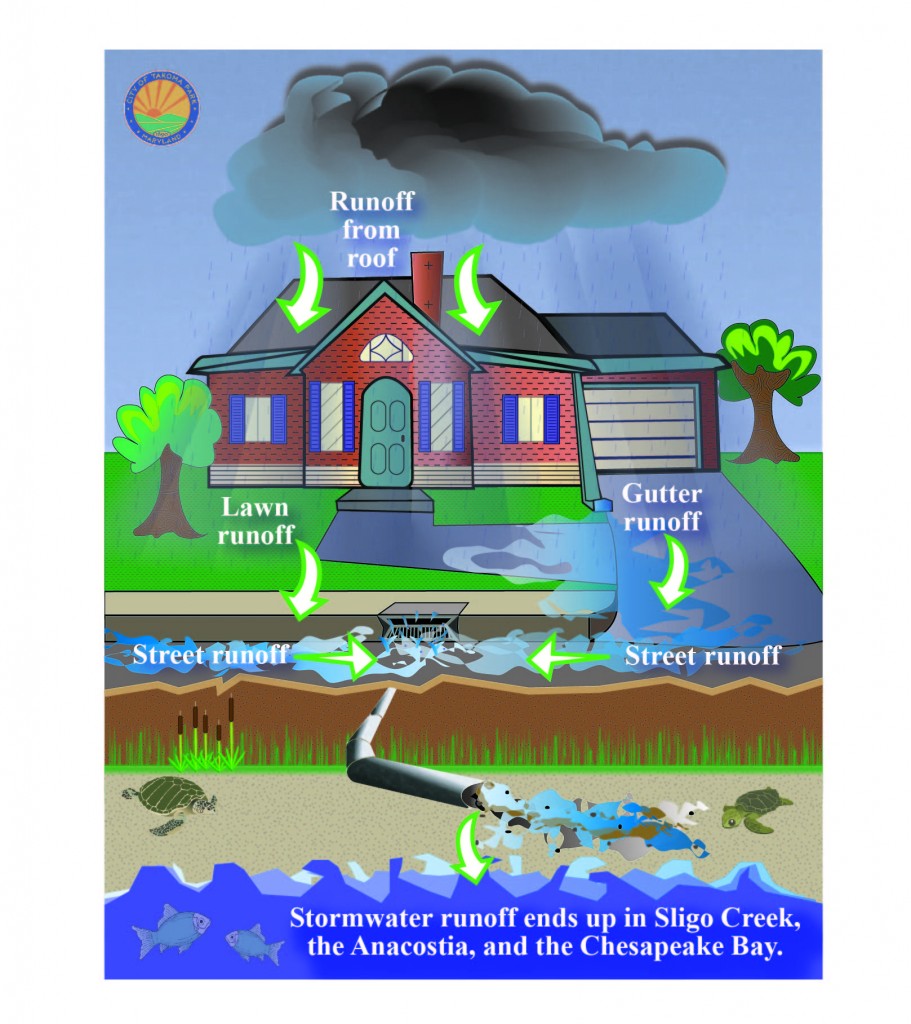
Stormwater is excess rainfall that is not absorbed by the ground, trees, or plants. This water flows over streets and other impervious surfaces, picking up oils, sediment, and other contaminants on its way to Sligo Creek, the Anacostia River, and the Chesapeake Bay.

As stormwater increases in volume and speed, it causes stream bank erosion and dumps more sediment into the stream, harming aquatic insects, fish and animals that depend on the stream for their food and habitat. The illustration to the left explains stormwater runoff graphically.
How Does the City Manage Stormwater
The City is making great strides to reduce the amount of impervious surface area, control erosion, and undertake projects that decrease the amount of contaminants and stormwater that enter local waterways. Some of these projects include:
- Installing stormwater management facilities such as bio-retention areas that use native plants and trees to filter pollution from storm runoff.
- Stream restoration and stabilization projects, such as the Circle Woods Stream project.
- Developing green streets, such as the Flower Avenue Green Street Project.
- Restricting the use of cosmetic pesticides through the Safe Grow Act.
- Maintaining stormwater infrastructure throughout the City.
What Can I Do to Help Keep the Bay Clean
Residents play a key role in reducing Takoma Park’s polluted stormwater runoff, preventing erosion, and decreasing the amount of sediment and contaminants entering our waterways and flowing to the Bay. Below is a list of some actions households can take to decrease their impact on stormwater:
- Sweep up yard debris, rather than hosing down areas and compost or recycle yard waste.
- Reduce the amount of paved and impervious area on your property. Vegetate bare spots in your yard with native plants to prevent soil erosion.
- Purchase non-toxic, biodegradable, and recyclable products whenever possible.
- Consider “BayScaping” or conservation landscaping your property. This type of yard requires very little maintenance and uses native ground cover, grasses, and vegetation.
- Install a rain barrel to collect and store rainwater that would otherwise enter the stormwater system and divert into local waterways on its way to the Bay.
My neighborhood has drainage problems. Who do I call to get some action on these problems?
You can call the City Department of Public Works at 301.891.7633. If the problem is a City responsibility, we will add it to our maintenance and repair schedule.
If you have a question about stormwater management or want to report a flooding or drainage problem, contact the City Engineer.
Ali Khalilian
City Engineer
Phone: 301-891-7620
Email: AliK@takomaparkmd.gov
The City of Takoma Park does not endorse, review, control, or recommend viewpoints, materials, or products contained in third-party websites unless noted.
Stormwater Fee Calculation
The City Council passed Ordinance 2021-12 on March 24, 2021, which changed the stormwater utility fee from a flat rate of $92 per single-family property to a tiered rate based on a $25 fee per 500 square feet of the impervious area. The new fee structure was implemented in FY22. For additional detail regarding the change in fee structure, please review the City Ordinance.
For each single-family property, the Montgomery County Parcel Database was used to determine the impervious area square footage. The database contains the most up-to-date impervious area analysis data available and is based on a tri-annual LIDAR evaluation that takes aerial images of the impervious area.
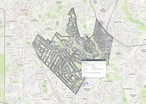
Click on the map below to view the impervious area for your address: Montgomery Planning Map.

Instructions for navigating the interactive impervious area map can be found here.
Quick Links
- Bioretention in Takoma Park
- Stormwater Facility Inspection and Maintenance
- Stormwater Permit Applications
- Stormwater Permit Fees
- Stormwater Resiliency Study
- Stormwater Fee FAQ
- Stormwater Management Projects
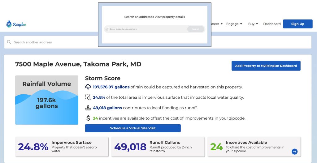
Introducing: Rainplan Stormwater Calculator

This tool created by Rainplan uses high resolution aerial imagery to calculate the amount of run-off a property generates based on impervious surfaces, tree cover and soil type. The tool also provides detailed information about possible ways to manage and reduce stormwater run-off. Rainplan offers a no cost virtual site to further discuss stormwater management measures, implementation costs and available contractors.
Use this link to see an evaluation of your property and the stormwater run-off generated: https://app.myrainplan.com/listing_detail
Stormwater Utility Fee Request For Correction
If a property owner believes there is an error, a correction may be requested. Grounds for correction of the fee include:
- Errors in the square footage of impervious surface area on the property
- Mathematical errors
- Property owner identification error
Please note that impervious area totals for private property exclude public sidewalks and roadways. All public space impervious areas that appear on private property in the Montgomery County impervious area map have been deducted from private property impervious area totals. The deductions have been incorporated into the stormwater fee for applicable properties.
To request a correction, use this Application Form.
The request for correction application can be completed online or printed and returned via email to publicworks@takomaparkmd.gov or by mail to Public Works at 31 Oswego Ave, Silver Spring, MD 20910.
A property owner may be required to provide documentation, such as a property survey, composed by a registered engineer or professional land surveyor when asserting an error in impervious surface calculation.
Stormwater Utility Fee Credit Policy
The City has developed a credit program to recognize efforts already taken by private property owners to reduce stormwater run-off from their property. The maximum credit available is a 50% reduction of the original Stormwater Utility Fee. Property owners can apply for one or multiple eligible credit categories. Credits are calculated based on the amount of the impervious area treated by the qualifying stormwater control facility.
Qualifying measures include:
- Tree planting (2 tree minimum)
- Rain Garden
- Bioretention Facility
- Bioswale
- Dry Well
- Permeable Pavement
- Green Roof
The Stormwater Utility Fee Credit Policy and Guidance Document can be found here: Stormwater Utility Fee Credit Policy and Guidance Document
To apply for a credit, use the Stormwater Credit Application Form
The Stormwater credit application can be completed online or printed and returned via email to publicworks@takomaparkmd.gov or by mail to Public Works at 31 Oswego Avenue, Silver Spring, MD 20910. The application does require submission of additional documentation to verify the details of the facility and the impervious area treated.
Fee Structure Rationale
In 2018, the City hired Black & Veatch to complete an impervious area review of properties in the City and recommend fee options. The study, published in January 2019, can be found here.
- Findings: Their analysis found that the average impervious area on single-family lots was larger and had a wider variation than originally assumed, with a range from 100 square feet to 10,500 square feet. The consultants recommended the City consider changing the stormwater fee for single-family properties from a flat fee to one that is tiered and based on the actual impervious area on the property. The amount of revenue generated by the proposed new fee structure would produce the same amount of funding as the current flat fee rate. The full report can be found here.
Stormwater Management Permit
A Stormwater Management Permit is required during (a) Additions or modifications to existing single-family detached residential structures disturbing 5,000 square feet or more; (b) Any exterior construction activity on commercial, industrial or institutional property, regardless of the size of disturbance.
Resources
Resources:
- What’s in the creeks?
- Bay 101: Monitoring and Modeling the Chesapeake Bay
- Green Landscaping Information
- Rain Barrel Information
- Introduction to Non-Point Source Pollution
Federal and State Stormwater Information Resources:
Volunteer for the City:
The City is looking for volunteers for its “Mark A Drain” campaign. Interested residents, please email the City Engineer at alik@takomaparkmd.gov. For more information on the campaign:
City Ordinances and Plans:
- Takoma Park Stormwater Management: City Code, Section 16.04.140
- Takoma Park NPDES Progress Report October 2020 – October 2023 (PDF)
- Takoma Park NPDES Progress Report October 2020 – October 2022 (PDF)
- Takoma Park NPDES Progress Report October 2020 – October 2021 (PDF)
- Takoma Park NPDES Progress Report July 1, 2019 – June 20, 2020 (PDF)
- Takoma Park NPDES Progress Report July 1, 2017 – June 30, 2018 (PDF)
- City of Takoma Park Flood Mitigation Plan (PDF)
- Watershed Implementation Plan Fiscal Year 2016-2017 Interim Updates (PDF)
- 2019 Dry Weather Water Analysis Report
- 2020 Dry Weather Water Analysis Report
- 2021 Dry Weather Water Analysis Report
- 2022 Dry Weather Water Analysis Report
- 2023 Dry Weather Water Analysis Report
FAQs:
- Learn more about Stormwater Fees please refer to: Stormwater Fees – Frequently Asked Questions (FAQs)
- The updated FAQ is also available as a PDF version: Click here to view/print the document.
